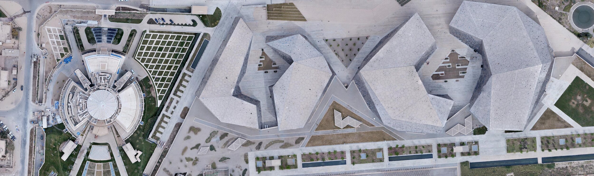
Overwatch uses a number of aerial imagery acquisition platforms to provide mapping at various scales and formats for our clients, according to their requirements. Using fixed-wing & multi-rotor (UAVs) according to the project type, Overwatch is able to respond rapidly to requests for the flying of aerial photography, with the height of flying determining the scale and accuracy of the resultant mapping (GSD). Deliverable to the client can be either Digital Terrain Models ( DTM ), or rectified orthophotos, or full, contoured topographic mapping with a custom interval based on the customer’s requirements. The use of the UAVs makes the preparation and updating of base mapping for Geographical Information Systems easy, accurate (1 - 3 CM), and fast, responding immediately to requests by clients. The company also is approved by the municipality, and we have done a lot of projects in Kuwait.

Construction

Inspection

Environmental
Protection
Aerial Surveying benefits!
30
Minutes to collect all survey-grade data
30+
File format supported for export
30x
Reduction in field survey hours

Survey Accurately in a fraction of time
Survey Accurately in a Fraction of the Time
We efficiently collect aerial data in order to improve site planning and quality control, manage assets, and reduce risk on the job site
Projects Progress Monitoring with Shareable Maps
Quickly create weekly drone maps of your site to track progress and instantly share data between team members across desktop and mobile devices
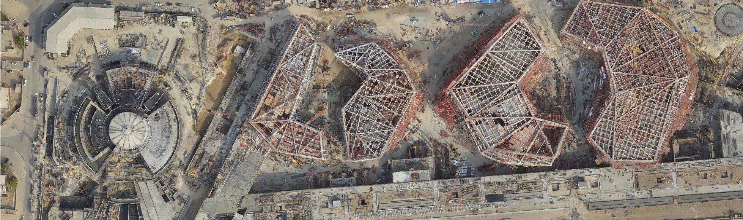
Compare BIM Models to Site Conditions
Bring design plans to life and make smarter quality assurance decisions by combining building information models with high-resolution point clouds of actual site conditions
How it Works!

Request a Drone Mission
Online or by Phone

Our Licensed & Insured
Pilots Do The Flying

Your Aerial Contents Is
Digitally Delivered to You
What You Receive

High resolution imagery
Receive high-resolution 20 megapixel imagery of your construction site(s) at all angles to view the site and monitor progress in vivid detail.

Ultra high definition 4K video
Receive ultra high-definition 4K videos of your construction site(s) from multiple angles to view and share the site and its progress in vivid detail.

Georeferenced, orthomosaic map of site
Receive a georeferenced, orthorectified map in HD which allows you to interactively view, pan & zoom in on your construction site(s) from above. Like Google Earth, but showing the site as it was on the date of the mission in vivid high resolution.

Interactive 3D model of the construction site
Overwatch can produce interactive 3D models of your construction site(s) that you can view and interact with online. Easily view and share your construction sites in 3D.

Files securely hosted by Overwatch
All files are securely hosted by Overwatch. Your files are encrypted with bank-grade AES 256 bit encryption while in transit and at rest.

Securely view, download & share your files
Overwatch makes it quick and easy for you to securely view, download, and share your files with others.

Save time and money
Overwatch captures interactive aerial views of your construction site(s) for you & helps reduce costs by eliminating the need for manned aircraft & manual tracking.

Receive files within 2 business days of mission
Overwatch provides you with secure access to view and download all media and files within 2 business days of conducting the drone mission.
Some of Our Clients